Land on the southern side of Node Hill, Studley
A welcoming new development with a diverse range of homes, generous green spaces and footpaths linking local routes.
Welcome to our public consultation website which will help to inform a planning application that is to be lodged in 2026. We look forward to receiving your views.
Site Location
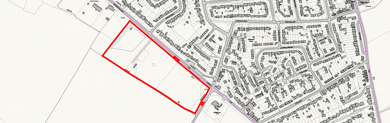
The application site comprises three parcels of land comprising some 4.6 hectares and is located to the southern side of Node Hill on the edge of Studley. The site comprises a mix of grazing land, equestrian and commercial yard.
The surrounding area comprises residential catchment area to the north; the Jubilee public house/restaurant lies to the south-east of the site at the junction of Middletown Lane and Bromsgrove Road with open fields to the south-west of the site. The site is enclosed by existing hedgerows interspersed with tree planting.
Access to the site is from Node Hill with a second access from Middletown Lane.
The site is located adjacent to but outside the built-up area boundary of Studley and forms part of the Green Belt and Arden Special Landscape Area.
The site is generally free of any physical constraints. It is situated in Flood Zone 1, the lowest risk of flooding, is not designated for its wildlife or ecological importance, and does not contain any known, designated or non-designated heritage or archaeological assets.
Planning Application Proposals
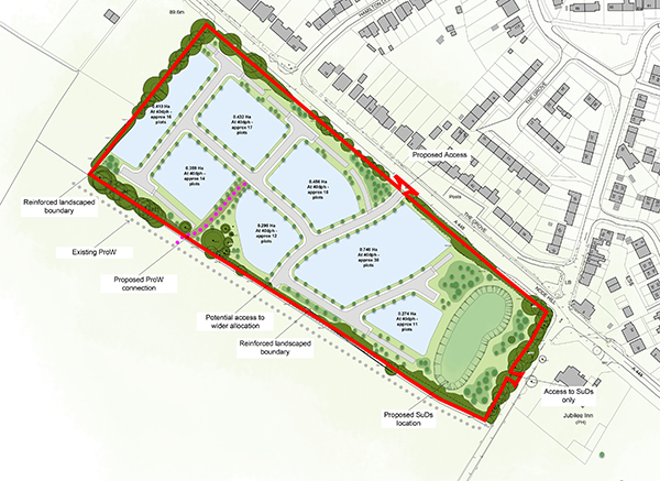
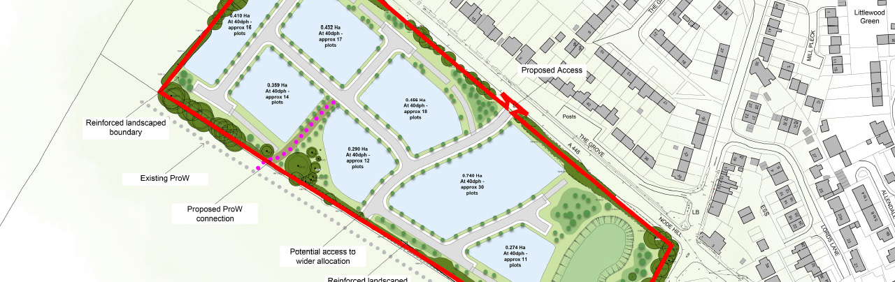
The proposal would comprise a residential development of around 110 dwellings, with associated blue and green infrastructure, landscape buffering, open spaces and BNG enhancement.
The proposed development would comprise a high-quality residential development of around 110 dwellings, with associated blue and green infrastructure, landscape buffering, open spaces and BNG enhancement.
The development would comprise a mix of house types and tenure with 50% of the housing being affordable.
A new access is proposed to the southeast of the current access directly onto Node Hill/Bromsgrove Road.
Associated infrastructure on site would include:
- Existing landscaping would be retained, supplemented and managed
- Tree loss would be limited, with the objective of retaining as far as possible the higher quality trees
- Replacement planting and new landscaping would be provided to mitigate loss, as part of an overall BNG strategy seeking net gain
- On site drainage attenuation
- Footpath connections to the existing Public Rights of Way network.
Supporting information
Further information in support of the plans to provide new affordable homes for Studley can be found by following the link below
Share your views
As part of the preparation of a planning application on the site we are keen to ascertain the community’s view on the illustrative material produced thus far.